
Scarborough 4D B1 Marine Seismic Survey
Overview
Full details of this EP including published Documents.
All open for comment EP's.
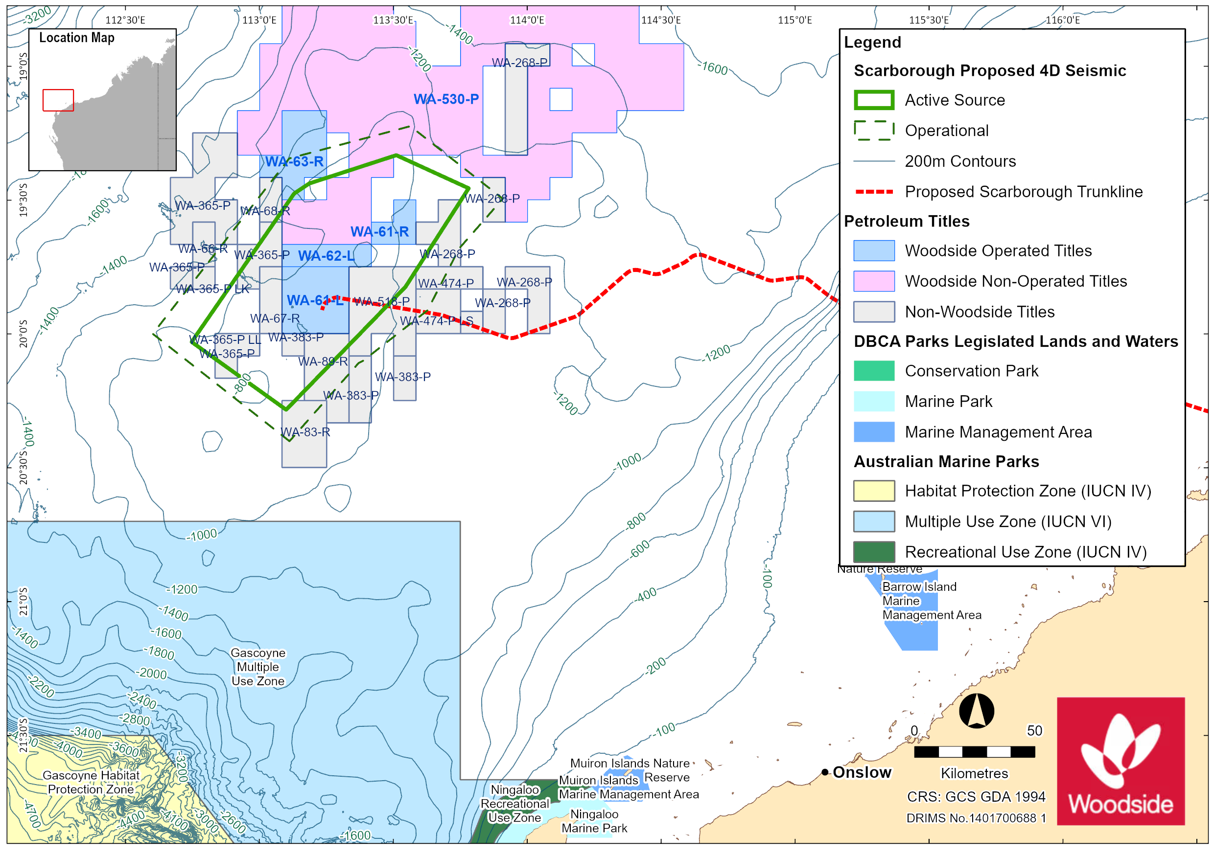
Woodside proposes to conduct a four-dimensional (4D) baseline marine seismic survey (MSS) over the Scarborough, North Scarborough and Jupiter gas fields within Commonwealth waters, located in the Carnarvon Basin. The proposed activity will occur within Permit Areas WA-61-L, WA-62-L and WA-61-R. The planned duration for the survey is 80 days, commencing in Q3 2022. The survey will occur no earlier than 1 January 2022 and will be completed by 31 December 2023.
The extent of the Active Source Area is approximately 5650 km2. The extent of the Operational Area is approximately 9200 km2. Water depths within the Active Source Area and Operational Area range from ~800m to 1150 m. The Operational Area is approximately; 201 km WNW of the Montebello Islands and Barrow Island, 188 km north-west of North-west Cape and 245 km north-west of Onslow.
Providing your comment
The public comment process provides an opportunity for community members to have their say on environmental management aspects of proposed oil and gas activites. To make a submission click on the link below.
If your comments contain sensitive information or if you are unable to use this platform for any reason please refer to our Public comment on environment plans brochure for alternative options to have your say.
Please be aware that information that is irrelevant to NOPSEMA’s decision making criteria cannot be considered, such as statements of fundamental objection to oil and gas activity, comments that contain personal threats or profanities, SPAM mail, comments made through online social media channels, petitions and comments that pose questions to NOPSEMA and or/the titleholder. NOPSEMA takes threats of a personal nature seriously and will consider legal action should the public comment process be misused to make personal threats to any NOPSEMA employee.
Share
Share on Twitter Share on Facebook